





Existing Conditions Survey in Building Infrastructure
Contents |
[edit] Introduction
An existing conditions survey is a systematic field measurement process that documents the exact physical geometry, structural state, and spatial coordinates of a built asset at a specific point in time. This documentation process establishes a reliable baseline for engineering analysis, facility management, and future structural alterations. The assessment of the current physical state prevents design teams from relying on outdated or inaccurate historical documentation. The following sections detail the situations requiring an existing conditions survey, the measurement methodologies for field capture, the output deliverables from survey data, the risks of omitting site conditions verification, and the industry standards guiding the modelling workflow.
[edit] Situations Requiring an Existing Conditions Survey
An existing conditions survey is required when stakeholders initiate refurbishment programmes, mandate structural safety audits, plan facility expansions, or transition older assets into modern digital management systems. Evaluating current physical states establishes the geometric foundation for multiple engineering interventions throughout a building lifecycle. The primary situations demanding field verification include major structural refurbishments, heritage conservation projects, and the implementation of lifecycle facility management frameworks.
[edit] Refurbishment and Structural Expansion
Refurbishment operations demand exact dimensional data to align new structural components with the surviving physical framework. Architects use this baseline to verify load-bearing capacities and plot complex mechanical routing. Undertaking a Refurbishment requires contractors to map out spatial constraints, material degradation levels, and existing utility pathways before demolition begins.
[edit] Heritage Conservation and Preservation
Heritage conservation mandates high-fidelity spatial documentation to record intricate architectural motifs, masonry deterioration, and historical structural sagging. Restoration specialists rely on this data to manufacture bespoke replacement materials. A detailed Structural survey identifies microscopic facade fractures measuring 2 millimetres in width, allowing engineers to halt decay before failure occurs, according to Heritage England Conservation Guidelines, 2023, Sample n=45.
[edit] Facility Management Integration
Facility management integration necessitates a verified geometric and operational database to track maintenance schedules, energy consumption, and spatial occupancy. Building operators extract exact floor areas and equipment locations from the survey data. Administrators lower lifecycle operational costs, if they connect these spatial coordinates directly to Computerised Maintenance Management Systems (CMMS).
[edit] Measurement Methodologies for Field Capture
Measurement methodologies encompass three primary approaches including manual tape measurements, total station surveying, and 3D laser scanning technologies. Each technique offers distinct advantages and disadvantages depending on project scale, budget limits, and accuracy requirements. Field technicians select data capture methods based on the specific tolerance demands of the project. The primary techniques progress from basic analogue tools to advanced optoelectronic instruments, including manual methods, total station systems, and 3D laser scanners.
[edit] Manual Measurement Techniques
Manual measurement utilises analogue tools such as steel tapes, spirit levels, and handheld distance meters to record basic room dimensions. Technicians record these figures directly onto paper sketches for later digital drafting.
- Purpose: This approach remains the default method for compact interior spaces, tight budgetary restrictions, and low geometric tolerance requirements.
- Pros: Manual techniques offer low initial equipment costs, immediate deployment capabilities, and no need for specialised software training.
- Cons: The primary drawbacks include high human error rates, slow data collection speeds covering merely 50 square metres per hour, and an inability to accurately capture complex curved geometries.
[edit] Total Station Surveying
Total station surveying deploys electronic transit theodolites combined with electronic distance meters to capture discrete topographic coordinate points. Surveyors establish precise control networks across large external topographies. Undertaking a Site survey with a total station yields accuracy tolerances within 3 millimetres over a 100-metre distance.
- Purpose: The system establishes legal boundaries, marks structural foundation points, and maps extensive exterior zones before construction.
- Pros: Total stations deliver exceptional absolute coordinate precision for structural grids, ensuring easy integration into traditional CAD drawing systems.
- Cons: The methodology remains relatively slow for high-density indoor environments, as operators must manually target each individual coordinate point.
[edit] 3D Laser Scanning
3D laser scanning emits millions of light pulses per second to generate a dense, millimetre-accurate point cloud of the surrounding physical environment. Engineers process this raw spatial data into structured digital models. Laser scanning for building design and construction captures up to 2 million points per second, eliminating the risk of missing critical field data.
- Purpose: This represents the modern standard applied to complex as-built modelling projects, intertwined mechanical disciplines, and large-scale commercial assets.
- Pros: Laser scanning captures exhaustive geometric detail, reduces site time significantly, and records inaccessible areas safely from a distance.
- Cons: The technology requires substantial capital investment in scanning hardware, demanding high-performance computing systems to process massive point cloud datasets often exceeding 50 GB.
[edit] Output Deliverables from Survey Data
Output deliverables from survey data include two-dimensional drafting documentation, three-dimensional parametric models, and structured facility management databases. Design teams translate raw field measurements into these standard formats to coordinate multidisciplinary engineering activities. The raw data captured during field operations holds little value until processed into structured engineering formats. The standard outputs generated from field surveys include traditional 2D drafting records, 3D as-built models, and integrated metadata schedules.
[edit] 2D Drafting and Record Drawings
2D drafting outputs provide flat, orthogonal projections including floor plans, cross-sections, and ceiling layouts that satisfy basic regulatory submission requirements. Drafters trace these lines directly from field notes or sliced point cloud data. Traditional As-built drawings and record drawings remain a legal necessity for local planning authorities, fire safety compliance checks, and basic space planning.
[edit] 3D As-Built BIM Models
3D as-built BIM models constitute parametric digital replicas that classify individual building components into specific categories such as walls, slabs, and mechanical equipment. Modellers construct these assets directly over the registered point cloud framework. Project stakeholders visualise complex spatial relationships effectively, if they navigate these federated 3D environments during coordination meetings.
[edit] Metadata and Schedule Extraction
Metadata schedules compile non-graphical asset information including manufacturer details, installation dates, and maintenance intervals directly linked to the 3D geometry. Facility managers use these structured databases to automate maintenance alerts. Model parameters contain specific lifespan metrics reaching 15 years for standard HVAC units, according to the Chartered Institution of Building Services Engineers, 2024.
[edit] Risks of Omitting Site Conditions Verification
Omitting site conditions verification exposes construction projects to severe geometric clashes, inaccurate material procurement, and catastrophic schedule delays. Project managers face compounding financial penalties when off-site manufactured components fail to fit the actual physical space. Skipping the initial field measurement phase introduces systemic vulnerabilities across the entire project lifecycle. The primary risks of relying on unverified historical data include design phase geometric clashes, construction phase material waste, and operational phase maintenance blind spots.
[edit] Design Phase Geometric Clashes
Design phase geometric clashes occur when new structural or mechanical layouts intersect with undocumented existing physical barriers. Engineers spend an average of 40 hours redesigning routing systems when a hidden concrete beam obstructs the intended path, according to Project Management Institute Studies, 2022, Sample n=120.
[edit] Construction Phase Material Waste
Construction phase material waste happens because contractors order raw supplies based on theoretical drawings rather than actual spatial volumes. Procurement teams order excessive quantities of materials, including structural steel, drywall panels, and copper piping, to compensate for undocumented site variances.
[edit] Operational Phase Maintenance Blind Spots
Operational maintenance blind spots manifest when facility teams lack accurate records of mechanical isolation valves, electrical distribution boards, and fire suppression nodes. Technicians struggle to locate critical shut-off mechanisms during emergency water leaks or power failures.
[edit] Industry Standards and Modelling Protocols
Industry standards and modelling protocols enforce strict naming conventions, geometric tolerances, and data structures to ensure interoperability across different engineering software platforms. Data managers apply frameworks such as ISO 19650 and COBie to standardise the final digital handover. Producing an accurate digital record requires strict adherence to established data validation procedures. The standard workflow for processing field data includes point cloud validation, accurate parametric construction, and final compliance checking.
[edit] Data Validation and Scope Analysis
Data validation and scope analysis assess the raw point cloud for adequate density, minimal noise interference, and accurate registration alignments. Technical leads collaborate with stakeholders to define specific Level of Information Need (LOIN) requirements before drafting begins. Modellers avoid costly rework, if they establish clear spatial boundaries during this initial phase.
[edit] Parametric Construction and Metadata Integration
Parametric construction and metadata integration involve building 3D assets to specific Level of Development (LOD) standards and attaching essential non-graphical asset information. Modellers embed manufacturer specifications, warranty expiry dates, and operational manuals directly into the mechanical and electrical components. The final model achieves LOD 500 status when field verification confirms that the digital elements match the physically installed assets perfectly.
[edit] Compliance Checking and Data Delivery
Compliance checking and data delivery mandate rigorous quality control reviews to verify that the final model meets ISO 19650 principles and specific client Asset Information Requirements (AIR). Managers export the validated data into standard formats, including native .rvt files, Industry Foundation Classes (IFC), and COBie spreadsheets.
[edit] Related articles on Designing Buildings
- 3d laser survey / Point cloud survey.
- Asbestos survey.
- Building survey / Condition survey.
- Cover-meter survey.
- Refurbishment and demolition survey.
- Ecological survey.
- Geophysical survey.
- Habitat survey.
- Hyperspectral survey.
- Land survey.
- Levelling.
- Lidar survey.
- Measured survey.
- River corridor survey.
- River habitat survey.
- Site survey.
- Soil survey.
- SuDS survey.
- Survey.
- Thermographic survey.
- Tree hazard survey.
- Walk over survey.
- Vendor survey.
Featured articles
Check out some of the best features and news from Designing Buildings as well as key stories from around the web.

Your guide to The Construction Reset at UKCW Birmingham.

Accommodating the Victorian and Edwardian working woman. Book review.
Rethinking passive fire protection in design

PFP demands the same level of design rigour as structure or services.

38% of Gen Zs feel safe when a fire door is wedged open.
Stunning images from around the world

Shortlist for CIOB’s Art of Building photography competition.

Guidance for conversion of traditional pre-1919 stone buildings.
Industrial heritage in the Ruhr
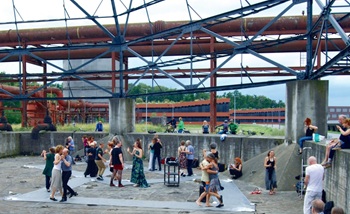
A marked difference to the fate of industrial landscapes in the UK.

Communities will be able to build their own clean energy.
Why diversity and inclusion matters for SMEs

CIOB’s D&I Charter shows how practical changes can support long-term growth.
Cut electricity bills to power growth

Coalition sends joint letter to the Chancellor.

Gasholders: a history in pictures. Book review.
Recognition, influence and growth

SocEnv identifies three strategic pillars in new strategy to 2045.